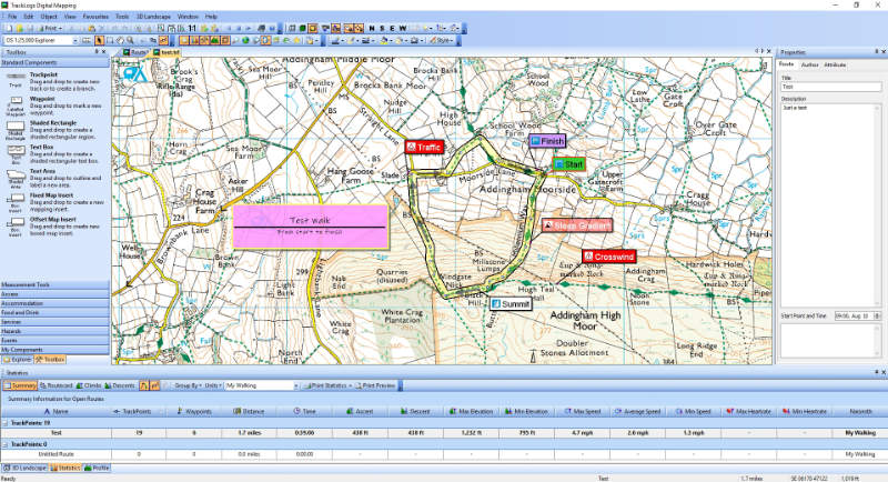
After a couple of weeks using Tracklogs, I’m happy with it. I haven’t gone for the full OS25 set yet because (a) it’s a bit pricey, and (b) the OS50 is much prettier for documenting walks (which I can create as GPX accurately with the OS Maps subscription). All my walk web pages have now been Tracklogised, and include (approximate before I had any GPS) a route card with whatever waypoints I want.
I did hit one problem after installing the full £100+ worth of OS50 GB maps. At first, everything was fine, but after a reboot, it was showing “Unlicensed Tile” in the map area. Reboots and reinstalls did improve it, but there was no elevation data showing… Not good. I eventually tracked it down to strange database files: Pcloud was trying to back up the files as they were doing the import, and so was renaming them with its [conflicted] suffix… So, simply a matter of not backing the database files up (no need – I have the product on CD and hard drive so can reimport any time).
I did open this as a problem with Tracklogs, then a follow up e-mail after I’d sorted it. But no response from them at all – this I find very poor.
